
What is 3RQ?

Water: One of our most precious and vital resources, it is essential for life and economic prosperity. Yet so many of the activities that keep our economy alive and growing also threaten our water resources.

At the West Virginia Water Research Institute, we understand how essential clean water is to our way of life. We work to establish programs and new initiatives that help to develop new technologies and inform policy to keep our water protected. It is this dedication to clean water that was the catalyst for the long-term, comprehensive water quality monitoring and reporting program we call Three Rivers QUEST (3RQ).

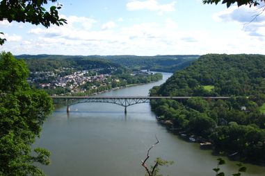
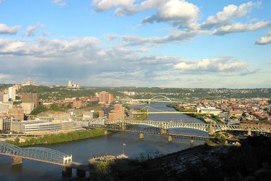
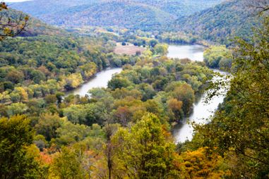
The 3RQ project monitors rivers, tributaries and headwater streams that drain an area of over 25,000 square miles in five states. It brings together academic researchers, citizen scientists, and conservation groups to collect, analyze, and monitor important water quality data. This data is displayed on the 3RQ website and can be seen here. This data is displayed to provide the public, other researchers, federal and state agencies, and industry with timely and accurate information as it pertains to the overall health of our local rivers and streams.

Featured Content

3RQ Members

We are seeking citizen-based groups who are interested in participating in the 3RQ program! Interested groups from throughout the Monongahela River Basin, Allegheny River Basin and Upper Ohio River Basin are welcomed to join the QUEST.

Read More: 3RQ Members

Chemistry With Dr. Z

Watch our resident water quality expert, Dr. Paul Ziemkiewicz, as he discusses a variety of water quality related topics in this informational video series called “Chemistry with Dr. Z.”

Watch the Videos

Our Rivers

Allegheny River

Allegheny River Basin

The Allegheny River Basin is a primary tributary of the Ohio River along with the Monongahela River. The two converge in downtown Pittsburgh to form the Ohio River. The Allegheny River itself is 325 miles long has a drainage area of 11,600 square miles.

Read More: Allegheny River
Monongahela River

Monongahela River Basin

The Monongahela River originates in north-central West Virginia and flows north through south-western Pennsylvania to Pittsburgh where it meets the Allegheny River to form the Ohio River. It is 128 miles long with a drainage basin of 7,340 square miles.

Read More: Monongahela River
Ohio River

Ohio River Basin

The Ohio River is formed by the confluence of the Allegheny and Monongahela River in downtown Pittsburgh, PA. The river is 981 miles long and flows to the Mississippi River at Cairo, IL. For the 3RQ program, our focus is on the Upper Ohio River Basin.

Read More: Ohio River

The Birth of 3 Rivers Quest

The West Virginia Water Research Institute (WVWRI) at West Virginia University has been actively researching water-related issues since 1967. When municipal water authorities were puzzled by the sudden increase of total dissolved solids (TDS) in late 2008, it was in the interest of WVWRI to find out what might be causing the changes in the water chemistry of the Monongahela River. While numerous programs exist that monitor water quality, the data collected was sporadic, and the studies did not include TDS. In response to the need for TDS data, WVWRI began a project in 2009 known as the Mon River QUEST. The project, funded by the USGS and WVWRI, has since won a Regional IMPACT Award by the National Institutes for Water Resources.

In 2011, thanks to the Colcom Foundation's funding, the program expanded to include areas surrounding the Monongahela River, Allegheny River, and Ohio River – now called the Three Rivers QUEST (3RQ). With the data input from grass-roots water monitoring organizations, 3RQ continues to manage data collected throughout the Upper Ohio River Basin. Geographically, the 3RQ Partners monitor the mainstem and mouths of major tributaries along the Allegheny, Monongahela, and Ohio Rivers.  In addition to routine monitoring monthly at 42 stations, 3RQ Partners have utilized Targeted Study funds to investigate community water quality concerns over such things as radiologicals in mine discharge and total trihalomethane in schools.  The REACH component of the program engages local watershed groups with data management and roundtable events and the WATERS database provides tools to store and analyze data.

News

Ancillary Content

Rivers run through this

Subscribe to our biweekly newsletter for grant opportunities, local news, and more!

Sign Up

WATERS Database Login


WATERS Database Login

Data Maps

See the differences in water quality at different locations at a glance and view changes over time.

Explore

Find Us On Facebook

View Facebook Page

Partners

Logo
Logo
Red Horse Environmental logo
Duquesne University logo
Colcom Foundation logo
Foundation for Pennsylvania Watersheds